The Ultimate Hokkaido Scenic Coastal Route: A Driver’s Guide
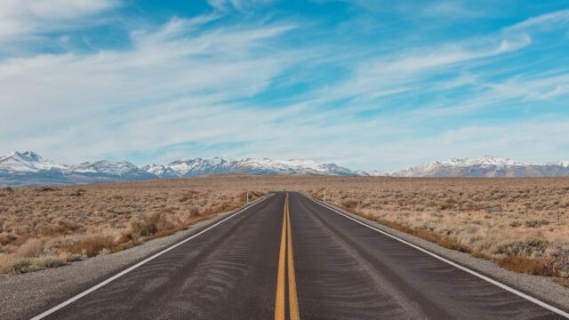
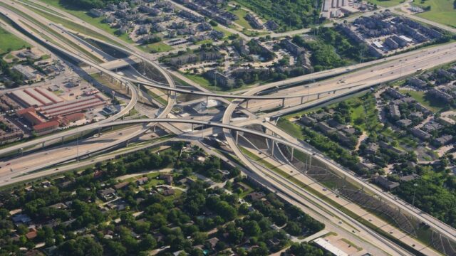
Hokkaido, Japan’s wild northern frontier, offers a driving experience unlike anywhere else in the country. While the main island of Honshu is defined by its densely populated urban centers, complex, multi-tiered expressways, and incredibly narrow mountain passes, Hokkaido is characterized by its sheer scale. Here, the roads are wide, straight, and stretch endlessly toward the horizon, cutting through vast agricultural plains and tracing the edges of dramatic, untouched coastlines. For international visitors accustomed to the cramped driving conditions of Tokyo or Kyoto, renting a car in Hokkaido feels incredibly liberating. It is the closest Japan comes to the classic American road trip experience. This guide details the ultimate scenic coastal route, circumnavigating the island’s perimeter to showcase the very best of its rugged natural beauty, abundant seafood, and unique driving culture.
Preparing for the Hokkaido Environment
Before embarking on a coastal road trip in Hokkaido, you must understand that the driving environment here operates by a different set of rules than the rest of Japan. The vast distances between municipalities, the lack of dense infrastructure, and the potential for severe weather require a higher degree of planning and self-reliance. You cannot assume that a 24-hour convenience store or a gas station will be available around every corner.
Managing Distances and Fuel
The most common mistake tourists make when planning a Hokkaido road trip is drastically underestimating the driving times. Looking at a map of Japan, Hokkaido appears compact compared to the rest of the archipelago, but it is actually massive—roughly the size of Austria. Driving from Hakodate in the extreme south to Wakkanai in the far north takes an entire day of continuous, non-stop driving, assuming perfect weather conditions. Therefore, you must plan your daily mileage extremely conservatively. Attempting to cover 400 kilometers in a single day will result in physical exhaustion and leave you absolutely no time to actually pull over and enjoy the spectacular scenery you came to see. A comfortable, sustainable pace is around 150 to 200 kilometers per day, allowing ample time for impromptu detours down local farm roads, extensive photography stops, and long, relaxed lunches at coastal seafood markets.
Crucially, you must proactively manage your fuel gauge. Outside of major urban centers like Sapporo or Asahikawa, gas stations become increasingly sparse, especially as you travel along the remote eastern and northern coasts. Many rural gas stations are small, family-owned operations that run on strict, limited hours, completely shutting down by 6:00 PM and remaining closed entirely on Sundays and national holidays. The golden rule of driving in Hokkaido is to never let your tank drop below half-full. The moment it hits the halfway mark, begin actively looking for the next available station and top it off. The profound anxiety of watching your fuel warning light illuminate on a deserted coastal road, 50 kilometers from the next known town as the sun goes down, is an experience you should actively strive to avoid. Always fill up before leaving a major town, regardless of how much fuel you think you currently have left. It is the cheapest and most effective form of insurance on the island, guaranteeing that you will not be stranded in an area with zero cellular reception.
Encountering Hokkaido Wildlife
The lack of dense human habitation along the coastal routes means that wildlife is abundant and frequently interacts with the road network. The most significant hazard is the Ezo sika deer (Yezo sika). These deer are massive, significantly larger than the species found on Honshu, and their population has exploded in recent years. They are most active at dawn and dusk, frequently darting across the highways with absolutely zero warning. Hitting a full-grown Ezo deer at 80 km/h will likely total your rental car and cause severe injury.
To mitigate this risk, you must exercise extreme caution during the twilight hours. If you are driving on a rural road surrounded by forests or tall grass, reduce your speed and actively scan the shoulders for movement. Many modern rental cars in Hokkaido are equipped with “deer whistles” mounted to the front bumper, which emit a high-frequency sound designed to warn animals away, but they are not foolproof. Furthermore, be acutely aware of the iconic “animal crossing” signs. In Hokkaido, these signs do not just feature deer; they also feature the Ezo red fox and, in specific eastern regions, the massive Ussuri brown bear. If you see a fox sitting near the road, do not stop to feed or photograph it; they are wild animals and stopping creates a dangerous traffic hazard. The presence of these animals is a testament to Hokkaido’s wild nature, but it demands your constant vigilance behind the wheel.
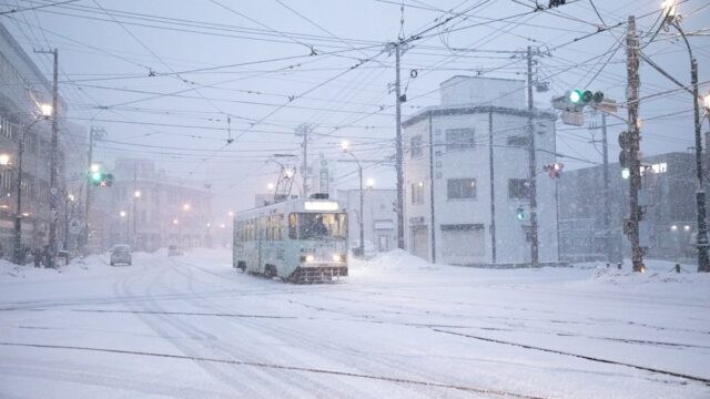
- Whiteouts: High winds blowing fresh snow can instantly reduce visibility to absolute zero. Pull over safely if you cannot see the road markers.
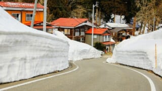
- Red Arrows: Pay attention to the red arrows suspended above the road. They indicate the physical edge of the asphalt when it is buried under snow.
- Black Ice: Temperatures frequently fluctuate across the freezing point. Assume bridges and shaded corners are covered in invisible black ice.
- Winter Tires: Mandatory and universally equipped on all Hokkaido rental cars from November to April. Check the tread depth before accepting the vehicle.
The Otaru to Wakkanai Stretch (The West Coast)
Starting from the historic port city of Otaru, located just west of Sapporo, this route travels straight north along the rugged coastline of the Sea of Japan, culminating at Wakkanai, the northernmost tip of the country. This stretch, primarily utilizing National Route 231 and Route 232, is characterized by dramatic cliffs, crashing waves, and incredibly intense sunsets. It is a lonely, beautiful drive that feels far removed from the tourist crowds of the central island.
The Ororon Line
The section of Route 232 stretching from Rumoi to Wakkanai is famously known as the Ororon Line, named affectionately after the local common murre bird (ororon-cho) that nests on the nearby islands. It is widely considered one of the greatest, most exhilarating driving roads in all of Japan, heavily favored by domestic motorcyclists and sports car enthusiasts. The road runs right along the absolute edge of the water, offering completely unobstructed, sweeping panoramic views of the dark, churning Sea of Japan on your left and vast, rolling green plains on your right. The landscape here is stark, windswept, and dramatic, completely devoid of the dense, mountainous forests that characterize the rest of the island. There are virtually no stoplights, no traffic jams, and very few buildings, allowing you to settle into a comfortable, hypnotic driving rhythm for hours at a time. It feels like driving at the very edge of the continent.
The absolute visual highlight of the Ororon Line is the massive wind farm located near the town of Horonobe. Dozens of towering, stark white wind turbines stand in a perfect, imposing line along the coast, their massive blades turning slowly against the backdrop of the ocean. It is an incredibly surreal and highly photogenic sight, emphasizing the vast, open space and the raw, natural power of the northern landscape. Further north, on a clear day, you can easily see the distinctive, perfectly conical silhouette of Mount Rishiri rising straight out of the ocean in the far distance, often referred to as “Rishiri Fuji.” The sheer lack of commercial infrastructure on the Ororon Line forces you to disconnect from modern distractions and focus entirely on the pure driving experience and the raw beauty of the natural world. It is the perfect, necessary antidote to the sensory overload of urban Japan. Taking the time to pull over at the various designated, empty parking areas to simply listen to the wind and the crashing waves is a mandatory part of the journey.
Cape Soya: The Northernmost Point
The ultimate culmination of the west coast drive is Cape Soya (Soya Misaki), proudly marking the absolute northernmost point of the Japanese archipelago. Standing at the iconic, triangular concrete monument, looking out across the choppy, frigid waters of the La Pérouse Strait, you can clearly see the dark landmass of the Russian island of Sakhalin on the horizon, just 43 kilometers away. It is a powerful, defining geographical location that provides a profound sense of accomplishment for any driver. The area is constantly buffeted by strong, freezing winds coming off the strait, regardless of the season, serving as a harsh, physical reminder of the extreme realities of this northern environment. The air feels noticeably different here—sharper and colder than anywhere else on the island.
Reaching Cape Soya is a recognized rite of passage for Japanese road trippers, cyclists, and motorcyclists. The local souvenir shops enthusiastically embrace this achievement, selling official certificates verifying the exact date and time of your arrival at the “Top of Japan,” which make for excellent, unique souvenirs. Beyond the monument itself, the surrounding hills feature unique, undulating “periglacial” landforms, created by the constant freezing and thawing of the soil over millennia. Driving up the short, steep, winding road to the hills directly behind the cape provides a sweeping, panoramic view of the entire strait and the surrounding wind-swept, treeless pastures. It is a stark, unforgiving, yet undeniably beautiful landscape that truly feels like standing at the very edge of the earth. Celebrating your arrival with a massive bowl of locally caught sea urchin (uni) or a steaming bowl of scallop ramen from one of the small, unassuming coastal restaurants is the perfect way to conclude the northern leg of the journey before turning south toward the wild eastern coast. It is a meal you must earn by conquering the long road north.
The Shiretoko Peninsula (The Wild East)
After navigating the northern tip of the island, the route heads southeast toward the Shiretoko Peninsula. This massive promontory juts out into the Sea of Okhotsk and is recognized as a UNESCO World Heritage site due to its incredible biodiversity and completely untouched ecosystems. This is the wildest, most rugged section of Hokkaido, where the dense, primeval forests extend all the way down to the ocean cliffs. Driving through Shiretoko requires a deep respect for the environment and an understanding that you are simply a guest in a truly wild habitat.
The Shiretoko Pass (Route 334)
The primary road intersecting the peninsula is National Route 334, which crosses the central mountain range via the legendary Shiretoko Pass. This is a dramatic, twisting alpine road that climbs sharply from the coastal fishing town of Utoro up to an elevation of 738 meters before plunging down toward Rausu on the eastern side. The drive up the pass is spectacularly beautiful, offering sweeping, unobstructed views of the Sea of Okhotsk and the jagged, active volcanic peaks of the Shiretoko mountain range. As you climb higher, the dense, ancient forests give way to creeping pine (kymatsu) and tough alpine vegetation, creating a stark, high-altitude environment that feels entirely removed from the coast below. The road itself is an engineering marvel, carving a precarious path through highly unforgiving terrain.
The weather at the top of the pass is notoriously unpredictable and can change in minutes. It can be perfectly clear, sunny, and warm at sea level in Utoro, while the summit is completely engulfed in a thick, freezing fog accompanied by howling winds. You must be prepared to drastically reduce your speed, utilize your fog lights, and monitor the electronic road signs carefully. During the late autumn, it is not uncommon for the pass to experience sudden, intense snow squalls, even while the coast remains entirely green and free of frost. Crucially, the Shiretoko Pass is completely closed during the winter months (typically from early November to late April) due to massive, impenetrable snowdrifts that simply cannot be plowed. Even during the peak of summer, the road is strictly closed at night to protect the local wildlife and prevent fatal accidents in the dark. Therefore, you must carefully plan your crossing during daylight hours. The view from the summit parking lot, looking out over the disputed Kunashiri Islands on a clear day, is arguably one of the most remote, politically significant, and spectacular vistas accessible by car in all of Japan.
Encounters with the Ussuri Brown Bear
The Shiretoko Peninsula is famously home to the highest concentration of Ussuri brown bears in the world. These massive, apex predators are the undisputed kings of the local ecosystem, and encountering them is a very real possibility when driving through the region, particularly near the coastal roads at dawn or dusk. While it might sound exciting to spot a wild bear from the comfort of your rental car, you must treat these animals with the utmost caution and absolute respect. The local authorities take bear safety incredibly seriously, and ignoring their regulations can have disastrous, potentially fatal consequences for both you and the bear. This is not a petting zoo; it is a genuinely wild environment where human presence is barely tolerated by the local fauna.
If you spot a bear while driving, the absolute rule is to never, under any circumstances, exit your vehicle. Do not roll down your windows to get a clearer picture, do not attempt to throw food to them, and do not linger on the narrow shoulder to take photographs. Slow down, pass the area safely at a steady speed, and continue your journey. “Bear jams,” where tourists stop their cars in the middle of the road to photograph wildlife, are a significant and dangerous problem in Shiretoko. They create massive traffic hazards on blind corners and, worse, habituate the bears to human presence, which often results in the bear ultimately having to be euthanized by rangers. The local rangers work tirelessly to keep the bears away from the roads and human settlements, and tourists stopping to gawk actively undermines their critical efforts. Your rental car provides a safe, secure environment; keep the doors locked, appreciate the incredible sighting from a safe, moving distance as you drive past, and report the sighting to the local visitor center later. This strict adherence to safety protocols ensures that both the tourists and the bears remain protected in this incredibly unique, shared environment.
The Pacific Coast (The Southern Route)
The final leg of the circumnavigation traces the southern coastline of Hokkaido along the Pacific Ocean, heading back toward the major transport hubs of Hakodate or Sapporo. This coastal region is distinctively different from the harsh northern routes or the wild eastern peninsula. It is characterized by dense, rolling fog banks, massive commercial fishing ports, and a slightly milder climate dictated by the warm ocean currents. The driving here is less about dramatic, isolated vistas and more about engaging with the rich, maritime culture that drives the local economy.
The Kushiro Shitsugen (Wetlands)
As you leave the wild eastern peninsula and head south, the route inevitably passes near the Kushiro Shitsugen, the absolute largest wetland ecosystem in all of Japan. While you cannot drive directly into the heart of the protected marshes, National Route 391 skirts the eastern edge, offering numerous elevated observation decks and small parking areas that provide sweeping, panoramic views of the vast, flat landscape. The wetlands are a stark, profound contrast to the dramatic, towering mountains of Shiretoko; they are an endless expanse of swaying green reeds, deeply meandering rivers, and dense, waterlogged forests that seem to stretch infinitely toward the horizon. It is a landscape defined by water and slow, quiet natural processes.
This specific area is globally famous as the primary sanctuary for the red-crowned crane (tancho), an iconic, culturally significant Japanese bird that was once tragically thought to be completely extinct. During the harsh winter months, these massive, elegant birds gather at specific, managed feeding sites located right near the road, drawing dedicated wildlife photographers and birdwatchers from around the world. Pulling over at the designated viewing areas to watch the cranes perform their complex, leaping courtship dances in the deep snow is an incredibly moving, once-in-a-lifetime experience. Even during the peak of summer, the wetlands are teeming with unique, migratory birdlife and offer a quiet, deeply contemplative break from the constant highway driving. The sheer, unbroken flatness of the Kushiro Shitsugen, extending to the horizon under the massive, famously wide Hokkaido sky, provides a profound sense of scale and tranquility, proving that the island’s beauty is not limited solely to its jagged mountains and crashing coastlines. Taking a detour to walk along the wooden boardwalks that extend into the edge of the marsh is a fantastic way to stretch your legs.
The Seafood Markets of Kushiro and Hakodate
The southern coastal drive is fundamentally a culinary journey. The busy commercial ports along the Pacific coast pull in some of the absolute highest-quality, most sought-after seafood in the world, and the local public markets are the perfect place to experience this incredible bounty directly from the source. In the port city of Kushiro, the massive Washo Market is famous for its “Katte-don,” a unique, highly popular system where you purchase an empty bowl of white rice and then wander through the chaotic market, buying small, individual portions of incredibly fresh sashimi directly from the various yelling vendors to create your own custom seafood bowl. It is a highly interactive, deliciously chaotic experience that allows you to sample a massive variety of local catches, from fatty salmon to rare local shrimp, for a fraction of the cost of a high-end sushi restaurant.
Further south, as the grand road trip finally concludes in the historic city of Hakodate, the legendary Morning Market (Asaichi) provides the ultimate culinary finale. Located just steps from the main train station, this massive, bustling complex of indoor stalls and small restaurants specializes in the heavy-hitting regional specialties: massive, spiky king crabs, incredibly sweet, giant scallops, and incredibly rich, briny sea urchin. Waking up early, walking through the chaotic, shouting vendors before the tour buses arrive, and sitting down to a breakfast of freshly caught squid (so fresh its tentacles are still moving on the plate) is the quintessential Hakodate experience. Returning your rental car after successfully navigating the entire massive perimeter of the island, and celebrating the long journey with a world-class seafood feast, provides a perfect, deeply satisfying conclusion to the ultimate Japanese road trip. The southern coast seamlessly blends beautiful, easy driving roads with incredible, unmatched gastronomic rewards, ensuring you finish the trip with a full stomach and incredible memories.
| Coastal Region | Key Route | Primary Hazard/Challenge | Highlight Destination |
|---|---|---|---|
| West Coast (Sea of Japan) | Route 232 (Ororon Line) | Extreme winds; long distances between fuel. | Cape Soya; Horonobe Wind Farm. |
| East Coast (Okhotsk/Shiretoko) | Route 334 (Shiretoko Pass) | Bears; sudden fog; winter road closures. | Shiretoko Pass Summit; Rausu. |
| South Coast (Pacific Ocean) | Route 391 / Route 38 | Dense coastal fog; heavy commercial trucks. | Kushiro Wetlands; Hakodate Morning Market. |
| Central Plains | Various Expressways | Ezo deer crossings; speed traps. | Furano flower fields; Biei rolling hills. |
Conclusion
Driving the complete coastal perimeter of Hokkaido is a massive, highly ambitious undertaking, but it is undeniably one of the greatest, most rewarding travel experiences available in Japan. It completely shatters the international stereotype of Japan as a purely urban, densely packed, hyper-modern nation, revealing a vast, wild, and incredibly rugged frontier that feels worlds apart from Tokyo. From the solitary, wind-whipped cliffs and massive wind turbines of the Ororon Line to the dense, bear-inhabited, primeval forests of the Shiretoko Peninsula, the island offers a staggering diversity of landscapes that demand a confident, prepared, and respectful driver. The wide, straight roads offer a profound sense of freedom and exploration that is incredibly rare on the main islands, allowing you to dictate your own pace, escape the rigid train schedules, and discover remote, untouched locations that the vast majority of tourists never see. It is the ultimate expression of automotive freedom in Japan.
However, executing this ultimate road trip requires a fundamental shift in how you approach driving in Japan. You must entirely abandon the assumption that convenience, 24-hour stores, and dense infrastructure are always guaranteed just around the corner. Managing your fuel supply proactively by filling up early and often, respecting the extreme, highly localized unpredictability of the northern weather, and remaining constantly vigilant for massive, unpredictable wildlife are absolute, non-negotiable requirements for a safe journey. By treating the harsh environment with the deep respect it commands, and planning your daily mileage conservatively to avoid driver fatigue, you unlock the true potential of Hokkaido. It is a journey that heavily rewards self-reliance, patience, and a deep appreciation for the raw, unfiltered beauty of the natural world. The memories forged while navigating these vast northern coastlines will remain with you long after the trip concludes, defining the absolute pinnacle of Japanese road tripping. It is an adventure that will forever change your perception of what Japan has to offer.