Top Apps to Check Real-Time Highway Tolls and Distances in Japan
Renting a car and driving across Japan is an incredibly rewarding way to see the country, offering unparalleled freedom to explore rural villages, scenic mountain passes, and hidden coastal towns that are difficult to reach by public transportation. However, one of the biggest sources of anxiety for international visitors planning a Japanese road trip is navigating the complex and often expensive expressway toll system. Unlike in some countries where highways are mostly free or charge a flat rate, Japanese expressways charge tolls based on the exact distance you travel, and the costs can add up surprisingly fast. Without the right tools, you might find yourself facing a hefty, unexpected bill at the end of your journey. Fortunately, modern technology has made it easier than ever to demystify these costs. By utilizing the right smartphone applications and online calculators, you can accurately estimate your travel expenses, find the most cost-effective routes, and monitor real-time traffic conditions before you even turn the ignition key. This comprehensive guide will introduce you to the essential apps and strategies you need to master Japan’s highway toll system.
The Importance of Pre-Trip Route Planning
When planning a driving itinerary in Japan, simply knowing the distance between two points is not enough. You must also factor in the financial cost of the route, as the toll fees can sometimes exceed the cost of the fuel you will burn. Failing to account for these expenses can seriously impact your travel budget, especially on long-distance journeys like driving from Tokyo to Kyoto or exploring the vast landscapes of Hokkaido. Effective pre-trip planning using specialized applications is the only way to ensure your road trip remains both enjoyable and financially predictable.
Why Relying Solely on Standard GPS is Risky
While standard GPS devices provided with your rental car and basic smartphone mapping applications like Apple Maps are excellent for turn-by-turn navigation, they often fall short when it comes to providing accurate, up-to-date toll information. Many built-in car navigation systems in Japan are slightly outdated, meaning they might not reflect the most recent changes in toll structures, newly opened expressway sections, or seasonal discount rates. Furthermore, these basic systems usually only show you the fastest or shortest route without giving you a clear breakdown of the costs involved, leaving you to guess how much you will be charged when you finally reach the exit gate.
Relying exclusively on these basic navigation tools can lead to unpleasant surprises. For instance, a standard GPS might route you through a premium toll road simply because it saves five minutes of driving time, even though a perfectly good, significantly cheaper parallel route is available. By the time you realize you have been routed onto an expensive tollway, it is usually too late to turn back, and you are forced to pay the higher fare. Furthermore, many of these systems do not seamlessly distinguish between the different operating companies that manage various sections of the highway network, which can sometimes lead to unexpected split-tolls if you transfer between them. To avoid these costly mistakes, you need applications that are specifically designed to calculate Japanese highway tolls, factoring in the complex variables like vehicle size, time of day, and whether you are using an ETC (Electronic Toll Collection) card. These specialized apps provide the transparency you need to make informed decisions about your travel routes, ensuring that you stay firmly in control of your transportation budget while on the road.
The Impact of ETC on Your Toll Calculations
Any discussion about calculating highway tolls in Japan must include the ETC (Electronic Toll Collection) system. Using an ETC card does not just make passing through the toll gates faster and more convenient; it also fundamentally changes the way your tolls are calculated. The Japanese expressway authorities offer a variety of significant discounts that are only available to drivers using an ETC card. For example, there are deep discounts for driving during late-night hours (midnight to 4:00 AM) or on weekends and national holidays. If you are trying to calculate your toll costs without factoring in these potential ETC discounts, your estimates will likely be much higher than what you will actually pay.
When choosing an app to calculate your route costs, it is crucial to select one that allows you to specify whether you will be using an ETC card. The most accurate applications will ask you to input your vehicle type (standard passenger car, light vehicle, etc.) and your payment method (ETC or cash). They will then automatically apply the relevant discounts based on the anticipated time you will pass through the toll gates. If you are an international tourist renting a car, you should absolutely request an ETC card from your rental agency. The rental fee for the card is negligible compared to the money you will save on tolls, and using an ETC-aware calculator app will help you maximize those savings by timing your drives to align with the discount periods.
- Late-Night Discount: 30% off tolls if you are on the expressway between midnight and 4:00 AM.
- Holiday Discount: 30% off tolls on weekends and national holidays (applies to regional expressways, not major city routes).
- Weekday Morning/Evening Discount: Based on frequent usage, though less relevant for short-term tourists.
- Smart Interchanges: Exclusive access to convenient ETC-only exits.
The Best Global Apps for Basic Navigation
For many international travelers, downloading a brand new, Japan-specific application just for a short vacation might seem like a hassle. Fortunately, the global mapping applications you probably already have installed on your smartphone can do a decent job of navigating Japanese roads, even if they lack the hyper-specific toll data of local apps. These global apps are incredibly user-friendly, support multiple languages seamlessly, and provide excellent real-time traffic updates, making them a solid starting point for your road trip planning.
Google Maps: The Reliable Standard
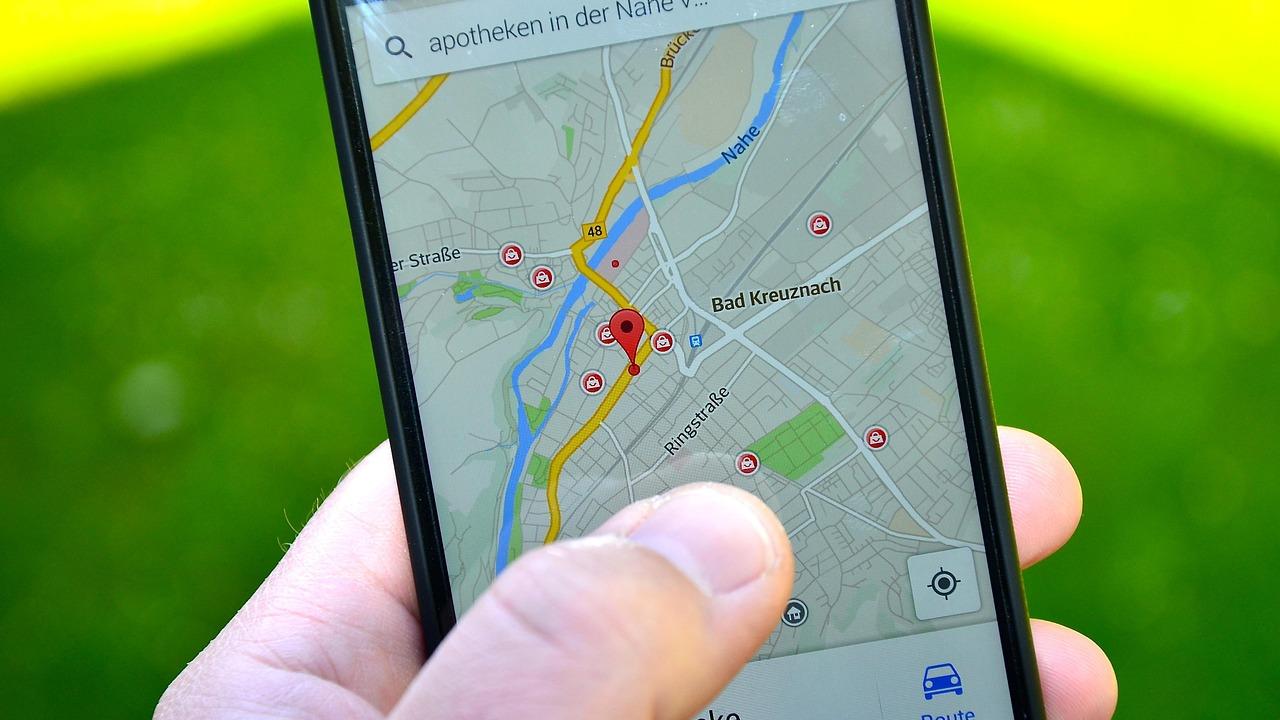
Google Maps is arguably the most essential navigation tool for any traveler in Japan, and it performs exceptionally well for driving. Its biggest advantage is the familiar interface and flawless English support. You can search for obscure landmarks, rural hotels, and specific restaurants in English, and Google Maps will almost always find the correct Japanese location. When you ask for driving directions, the app typically provides several route options, clearly highlighting which routes involve tolls and estimating the total driving time based on historical and real-time traffic data.
However, Google Maps does have a significant limitation when it comes to Japanese expressways: it generally does not provide the exact monetary cost of the tolls. It will warn you that “this route has tolls,” but it won’t tell you if that toll is 500 yen or 5,000 yen. This lack of financial transparency means you cannot use Google Maps alone if you are trying to stick to a strict travel budget. To get the most out of Google Maps, you should use it in conjunction with a dedicated toll calculator. Use Google Maps to find the best route and check the real-time traffic congestion, and then plug that specific route into a toll calculator to find out exactly how much it will cost.
Despite this drawback, Google Maps excels at real-time traffic monitoring. The color-coded traffic lines are highly accurate in Japan, quickly turning red or dark red to warn you of upcoming congestion or accidents on the expressway. The app will proactively suggest faster alternative routes if a major traffic jam develops ahead of you, which is an invaluable feature during busy travel periods like Golden Week or Obon. As long as you are aware of its limitations regarding exact toll pricing, Google Maps remains an indispensable tool for navigating the Japanese road network.
Apple Maps: Improved Visuals and Integration
Apple Maps has seen massive improvements in its Japanese mapping data over recent years and is now a very strong competitor to Google Maps for driving navigation. One area where Apple Maps particularly shines is its visual presentation of complex highway interchanges. Japanese expressways, especially in urban areas like Tokyo and Osaka, frequently feature multi-level, looping junctions that can be incredibly confusing to navigate. Apple Maps provides very clear, 3D-style lane guidance that makes it much easier to understand exactly which lane you need to be in to take the correct exit or transition to a connecting highway.
Like Google Maps, Apple Maps offers excellent real-time traffic updates and will route you around major delays. It also integrates seamlessly with Apple CarPlay, which is increasingly available in modern Japanese rental cars. Being able to project the navigation map directly onto the car’s built-in infotainment screen makes driving much safer and more convenient than constantly glancing down at your phone. The voice guidance is prompt and clear, giving you plenty of warning before you need to make a maneuver.
Unfortunately, Apple Maps shares the same critical weakness as Google Maps: it does not consistently display accurate, detailed toll costs for Japanese highways. You will be routed efficiently, and you will know that tolls are involved, but the exact financial impact of the journey remains a mystery until you arrive at the toll gate. Additionally, Apple Maps sometimes struggles to perfectly identify very remote or newly built rural roads as quickly as local Japanese mapping software does. Therefore, Apple Maps should be viewed as a premium navigation aid rather than a budgeting tool. Use it for its superior visual guidance at complex interchanges, but rely on specialized Japanese tools to calculate your actual travel expenses beforehand. When driving in heavy traffic or navigating unfamiliar urban centers, the clear, distraction-free lane guidance of Apple CarPlay makes it an invaluable companion, provided you have already managed the financial planning step separately.
Specialized Japanese Toll Calculation Tools
To get the exact cost of your highway journey down to the yen, you need to use the specialized tools developed specifically for the Japanese expressway network. While some of these tools are primarily in Japanese, they are often intuitive enough that you can use them with the help of your browser’s translation feature. These are the tools that factor in all the complex variables—ETC discounts, vehicle sizes, and specific entry/exit interchanges—to provide you with a perfectly accurate financial estimate for your road trip.
NAVITIME Drive Supporter
NAVITIME is one of the most powerful and popular navigation services in Japan, and their “Drive Supporter” app is widely considered the gold standard for comprehensive route planning. The most significant advantage of NAVITIME is its ability to provide incredibly detailed, highly accurate toll calculations. When you input your starting point and destination, the app will generate multiple route options, such as the “fastest route,” the “cheapest route,” and the “eco-route.” Most importantly, it clearly displays the exact toll cost for each option, allowing you to instantly compare the time saved against the money spent.
To get the most accurate results from NAVITIME, you must dive into the settings and configure your vehicle profile. You need to specify that you are driving a standard passenger car (普通車) and that you will be using an ETC card. Once configured, the app will automatically calculate all applicable ETC discounts based on your departure time. For example, if you plan a route that puts you on the highway at 2:00 AM, the app will correctly apply the 30% late-night discount to the estimated toll. This level of detail is something that global mapping apps simply cannot provide.
While the full NAVITIME Drive Supporter app is subscription-based and primarily targeted at Japanese residents, they do offer web-based route search tools and tourist-focused applications (like “Japan Travel by NAVITIME”) that incorporate some of these powerful toll calculation features. Even if you only use the free web version with Google Translate, plugging your starting and ending interchanges into NAVITIME is the best way to get a reliable estimate of your highway expenses before you start driving. It is worth noting that if you plan to drive extensively across multiple regions for several weeks, paying for a short-term subscription to the full Japanese app might actually pay for itself through the savings you discover by identifying cheaper alternative routes. The sheer depth of the data, including accurate warnings about speed cameras and complex junction layouts, makes it a top-tier choice for serious road-trippers who are comfortable navigating a slightly more complex user interface.
NEXCO’s Official E-NEXCO Drive Plaza (DraPla)
If you want the most authoritative source for highway toll information, you should go straight to the source: NEXCO (Nippon Expressway Company), the organization that actually operates the vast majority of Japan’s expressways. NEXCO operates a highly useful web portal called E-NEXCO Drive Plaza, commonly referred to as “DraPla” (ドラぷら). This website features a dedicated toll and route search function that is specifically designed to calculate the exact cost of traveling between any two highway interchanges in the country.
The DraPla search tool is incredibly detailed. You input your departure interchange, your arrival interchange, your vehicle type, and the date and time of your travel. The system then queries the official toll database to provide the exact cost, breaking it down into the standard cash fare and the discounted ETC fare. It will explicitly show you if a holiday discount or late-night discount is being applied based on the time you entered. Because this data comes directly from the expressway operators, it is the most accurate toll calculation you can possibly get.
The main challenge for international tourists using DraPla is the language barrier, as the site is primarily in Japanese. However, because the interface is essentially just a search form, it is very easy to use with a browser translation extension. The hardest part is usually knowing the exact names of the interchanges you plan to use, rather than just the city names. A good strategy is to use Google Maps to find the name of the interchange closest to your hotel, and then plug that specific interchange name into the DraPla website to get your exact toll quote.
| App / Service | Best Feature | Limitation for Tourists |
|---|---|---|
| Google Maps | Real-time traffic, great English UI | Does not show exact toll costs |
| Apple Maps | 3D lane guidance, CarPlay integration | Does not show exact toll costs |
| NAVITIME | Detailed route options with exact pricing | Full app requires subscription/Japanese |
| NEXCO DraPla | 100% accurate official toll data | Web-based, primarily in Japanese |
Strategies for Finding the Best Interchanges
Calculating your tolls accurately depends entirely on knowing which highway entrances and exits you will be using. If you just enter a general city name into a calculator, the system has to guess which interchange you intend to use, which can drastically alter the estimated price. Learning how to identify the most efficient interchanges for your specific destinations is a crucial skill for mastering Japanese road trips and keeping your toll costs under control.
Identifying the Closest IC (Interchange)
In the Japanese expressway system, entrances and exits are referred to as Interchanges (IC). When you are planning a drive to a specific tourist attraction, a hotel, or a rural town, your first step should be identifying the closest IC. You can do this easily on Google Maps by searching for your destination, zooming out slightly, and looking for the distinct green highway lines. The points where local roads connect to these green lines are the interchanges, and they are usually labeled with a green icon and the letters “IC” (e.g., “Gotemba IC” or “Kyoto-Minami IC”).
Once you have identified the closest IC to your destination, you need to do the same for your starting point. These two IC names are the critical pieces of data you need to feed into a toll calculator like NEXCO’s DraPla. By calculating the toll from IC to IC, rather than from city center to city center, you eliminate the guesswork and get a perfectly accurate price. It is important to note that a single city might have multiple interchanges (for example, Kyoto has Kyoto-Higashi IC and Kyoto-Minami IC). Choosing the wrong one can result in extra driving time on congested city streets, so always pick the IC that offers the most direct local route to your final stop. Spending a few extra minutes on Google Maps to verify the exact names and locations of these interchanges is a crucial step that distinguishes novice drivers from seasoned road-trippers in Japan, ensuring that you don’t inadvertently waste time navigating dense urban traffic when a better highway exit was available just a few kilometers down the road.
Sometimes, the closest IC might not actually be the most cost-effective choice. If your destination is located near the boundary of a major metropolitan toll zone, getting off one stop earlier might save you a significant amount of money in exchange for just a few extra kilometers of driving on local roads. This is where advanced tools like NAVITIME become useful, as they can sometimes highlight these cost-saving alternative exits if you choose the “cheapest route” option.
Utilizing Smart Interchanges (ETC Only)
As you study the map looking for interchanges, you might notice some labeled as “Smart IC.” These are a relatively recent addition to the Japanese expressway network and represent a fantastic convenience for drivers equipped with an ETC card. Smart Interchanges are essentially small, unstaffed toll gates that are fully automated. They are often built onto existing Service Areas (SA) or Parking Areas (PA), or connected to smaller local roads where a full-sized interchange wouldn’t fit.
Smart Interchanges are extremely important for route planning because they are exclusively for ETC users; you absolutely cannot use them if you are paying with cash or a standard credit card. If you have an ETC card from your rental agency, these Smart ICs open up a whole new level of flexibility. They often provide much more direct access to specific tourist spots, rural parks, or industrial areas, allowing you to bypass the traffic congestion that often builds up around the major, full-sized interchanges.
When you use an app to plan your route, make sure you have the ETC option enabled in the settings. If you do, the app will automatically consider Smart ICs when calculating the most efficient path. If you do not have ETC enabled, the app will pretend these convenient exits do not exist and route you to a regular toll gate further away. This is just one more reason why securing an ETC card is the single most important step in preparing for a Japanese road trip. It not only saves you money through discounts but also gives you access to a more extensive and convenient network of highway exits. Because Smart ICs are often attached directly to Service Areas, they also provide the unique advantage of letting you take a break, use the restroom, grab a quick meal, and then immediately exit the highway to reach your final destination, rather than having to drive an additional twenty minutes on local roads just to find a place to stop.
Combining Apps for the Ultimate Road Trip Toolkit
No single application is perfect for every aspect of driving in Japan. The global apps lack specific toll pricing, while the highly accurate local Japanese calculators often lack seamless English navigation interfaces. The secret to a stress-free and financially predictable road trip is not finding one magical app, but rather combining the strengths of several different tools to create a comprehensive navigation strategy. By understanding how to use these apps in tandem, you can navigate like a local.
The Pre-Trip Planning Workflow
Your road trip planning should ideally happen in the comfort of your hotel room the night before you drive, rather than while sitting in the rental car parking lot. Start your workflow with a global mapping app like Google Maps on a larger screen (like a tablet or laptop). Input your starting location and your final destination to get a visual overview of the journey. Note the suggested route, the estimated driving time, and specifically write down the names of the entrance IC and the exit IC that the map suggests you use.
Next, take those specific IC names and open a toll calculation tool like the web version of NEXCO’s DraPla. Input the entrance and exit interchanges, ensure you select a standard passenger car and ETC payment, and enter the approximate time you plan to be on the road. The DraPla site will generate the exact toll cost. Write this number down in your itinerary notes. You now have a solid understanding of both the route you will take and exactly how much it will cost, completely eliminating the anxiety of facing an unknown toll fee.
If the toll cost seems exceptionally high, this is the time to experiment. Go back to the calculator and see what happens if you change your departure time to qualify for the late-night discount. Or, go back to Google Maps, drag your route to use local roads for a portion of the journey, and then recalculate the tolls for the shorter highway section. This iterative process allows you to find the perfect balance between saving time and saving money before you even turn the steering wheel. Remember that while taking local roads saves toll money, it will dramatically increase your driving time due to lower speed limits, traffic lights, and local congestion. By having both the time estimate from your global app and the cost estimate from the Japanese toll calculator, you can make an informed, confident decision about whether the financial savings justify the additional hours spent sitting in the driver’s seat. This proactive planning is the cornerstone of a successful trip.
Real-Time Adjustments on the Road
Once you are actually in the car and driving, your strategy should shift from financial planning to tactical navigation. This is where your smartphone running Google Maps or Apple Maps (ideally connected to the car’s display via Apple CarPlay or Android Auto) takes over. You already know what the tolls will cost based on your pre-trip planning, so your primary concern now is safely following the route and reacting to dynamic traffic conditions.
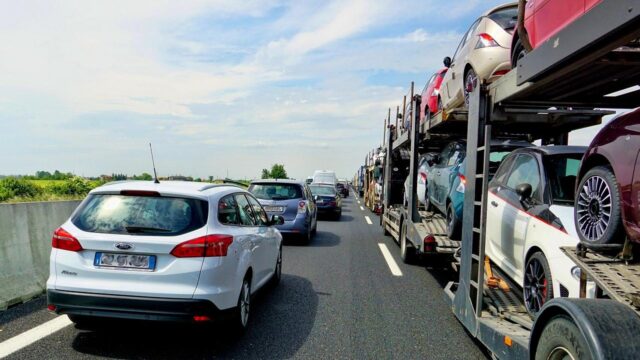
Keep your global navigation app running on the screen at all times to monitor the real-time traffic flow. If the map suddenly turns red ahead, indicating a major traffic jam or an accident, you need to decide how to react. The navigation app will usually offer a faster alternative route if one exists. If the app suggests exiting the expressway early and using local roads to bypass the congestion, you can confidently take that advice, knowing that getting off the highway early will actually reduce the toll cost you calculated the night before.
It is also incredibly helpful to listen to the highway radio broadcasts at 1620 kHz if you are stuck in traffic. Even if you don’t speak Japanese, the electronic signs on the highway will often display travel times to upcoming interchanges. By combining the real-time visual data from your navigation app with the official updates from the highway signs, you can make intelligent, on-the-fly decisions about when to stop at a Service Area for a break, or when it is worth jumping off the expressway to find a smoother path to your destination. Having a dedicated passenger act as the navigator is highly recommended; they can constantly refresh the maps, monitor the toll costs if you decide to change routes mid-journey, and keep an eye out for upcoming Smart Interchanges. This collaborative approach to real-time adjustments ensures that the driver can remain entirely focused on navigating the road safely, without the dangerous distraction of fiddling with apps or calculating expenses while driving at highway speeds.
Conclusion
Mastering the Japanese expressway system requires a bit more effort than simply typing a destination into a GPS and following the voice commands. Because the tolls are calculated strictly by distance and can be quite expensive, taking a proactive approach to route planning is essential for any international tourist renting a car. The key to a successful and financially stress-free road trip lies in understanding that no single application provides everything you need. You must combine the strengths of familiar global mapping tools with the precise financial data provided by specialized Japanese toll calculators.
By using tools like Google Maps or Apple Maps for visual routing and real-time traffic updates, you can safely navigate the complex interchanges and avoid major delays. By pairing those maps with official tools like NEXCO’s DraPla or the NAVITIME web service, you can accurately estimate your toll costs down to the yen before you ever encounter a toll gate. This combination eliminates the fear of unexpected expenses and allows you to budget your travel funds effectively.
Most importantly, securing an ETC card from your rental agency is the linchpin that makes this entire system work efficiently. Not only does it streamline the physical process of passing through the toll gates, but it unlocks significant financial discounts and provides access to convenient Smart Interchanges that are completely off-limits to cash-paying drivers. Armed with the right applications, a bit of pre-trip planning, and an ETC card, the Japanese expressways transform from an intimidating hurdle into a remarkably efficient and enjoyable way to experience the breathtaking beauty of the country. Do not let the complexity of the toll system deter you from exploring Japan by car. By taking advantage of the technological tools available and investing a few minutes each evening to chart out your next day’s journey, you will find that driving here is one of the most memorable and rewarding travel experiences possible. Your careful preparation will pay off in the form of a smooth, predictable, and incredibly satisfying road trip adventure.