Decoding Japanese Highway Radio: Essential 1620 kHz Information
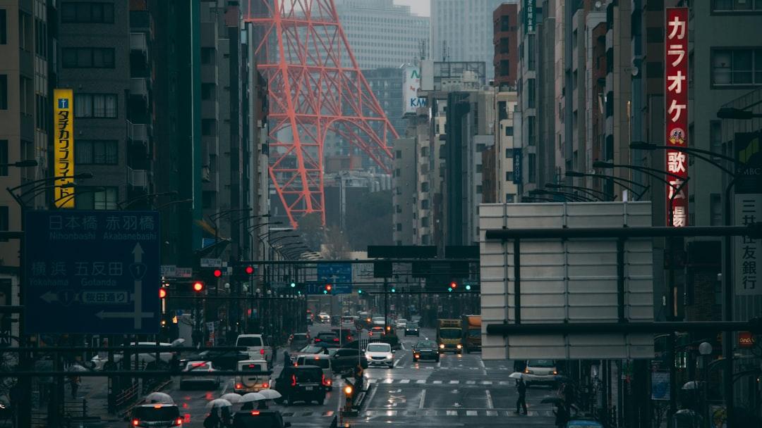
Driving on the Japanese expressway system can be an incredibly smooth and efficient experience, thanks to world-class infrastructure and immaculate road surfaces. However, long-distance driving in Japan is rarely without its challenges. The archipelago is highly susceptible to sudden and severe weather changes, intense traffic congestion during national holidays, and occasional seismic activity. To ensure that drivers have constant access to real-time, critical information regarding the road ahead, the highway operators manage a dedicated, highly localized broadcasting system known as Highway Radio. For an international visitor driving a rental car, noticing the frequent signs instructing you to tune your AM radio to 1620 kHz can be confusing. What exactly is this system, how does it work, and is it useful if you do not speak fluent Japanese? This comprehensive guide will decode the Japanese Highway Radio system, explaining its function, how to use it, and how modern technology allows you to access this vital safety information even without local language skills.
The Purpose of Highway Radio 1620 kHz
Highway Radio is a localized AM radio broadcast system specifically designed to transmit continuous, real-time traffic and weather updates to drivers on Japan’s expressways. Unlike standard commercial radio stations that broadcast over large regions, Highway Radio uses a series of closely spaced, low-power transmitters installed directly along the highway. This means that the information you hear on 1620 kHz is hyper-specific to the exact stretch of road you are currently driving on, providing crucial updates about the conditions immediately ahead of you. It is a vital component of the nation’s intelligent transportation infrastructure, designed to prevent secondary accidents and alleviate sudden congestion.
Real-Time Traffic and Accident Reporting
The primary function of the 1620 kHz broadcast is to alert drivers to sudden changes in traffic conditions. When an accident occurs on the expressway, every minute counts in preventing a dangerous pile-up. The Highway Radio system is linked directly to the regional highway control centers, which monitor the roads using thousands of closed-circuit cameras and electronic sensors. If an incident is detected, an automated or live broadcast is immediately pushed to the transmitters near the accident site. This broadcast will tell drivers exactly where the incident occurred, which lanes are blocked, and how long the resulting traffic jam currently stretches. This instantaneous communication is absolutely critical for maintaining high-speed safety on heavily trafficked routes.
By providing this information miles before drivers actually reach the tail end of the traffic jam, the system allows you to slow down safely, preventing rear-end collisions that often occur when high-speed traffic suddenly encounters stopped vehicles. Furthermore, the radio broadcasts frequently suggest alternative routes or advise drivers to exit the expressway at the nearest interchange to bypass the worst of the congestion. This real-time, hyper-local reporting is significantly faster and more accurate than relying on a smartphone navigation app, which might take several minutes to update its traffic algorithms. The immediate, localized nature of Highway Radio makes it an indispensable tool for safe highway navigation, especially during peak travel periods like the New Year holidays or Obon, when traffic jams can stretch for dozens of kilometers. In many cases, acting upon a Highway Radio broadcast warning can save you hours of sitting in gridlock, allowing you to salvage a travel day that would otherwise be ruined by unexpected delays. It is a highly proactive system designed to keep the massive volume of Japanese traffic moving as efficiently as physically possible, regardless of the circumstances.
Crucial Weather and Natural Disaster Alerts
Beyond traffic accidents, the Highway Radio system is essential for broadcasting severe weather warnings and natural disaster information. Japan’s mountainous terrain means that weather conditions can change drastically within just a few kilometers. A sunny drive in the valley can suddenly turn into a blinding snowstorm as you ascend a mountain pass, or heavy rains can trigger sudden landslide warnings. The 1620 kHz broadcast provides hyper-localized weather forecasts, alerting drivers to strong crosswinds on upcoming bridges, heavy fog in mountain valleys, or unexpected snow accumulation that might require the immediate installation of snow chains. This proactive weather reporting is crucial for preventing multi-vehicle accidents during sudden squalls or typhoons.
In the event of a significant earthquake—a reality of life in Japan—the Highway Radio system becomes a critical lifeline. If a major seismic event triggers automatic expressway closures, the radio will immediately broadcast instructions on how to safely bring your vehicle to a halt, where to evacuate, and which sections of the highway have been damaged. The system operates on emergency backup power, ensuring that even if the main power grid fails, drivers will not be left stranded without information. This level of comprehensive, localized emergency broadcasting is rare in many other countries, reflecting Japan’s deep commitment to public safety and disaster preparedness. For an international driver unfamiliar with the local terrain and weather patterns, tuning in to this station when the warning signs flash is a crucial step in ensuring a safe journey. It provides a level of reassurance that even in the face of unpredictable natural forces, the highway authorities are actively monitoring the situation and guiding drivers to safety. You are never truly isolated, even in the most remote mountain passes.
- Flashing Yellow Lights: When the highway information boards flash yellow, an important message is actively broadcasting.
- Severe Weather: Tune in during heavy rain, sudden fog, or when approaching snowy mountain passes.
- Major Holidays: Check the station frequently during Golden Week or Obon to anticipate massive traffic jams.
- Emergency Stops: If traffic suddenly halts completely, the radio will provide the reason and expected delay.
How to Identify Broadcast Zones
The Highway Radio system does not cover every single kilometer of the expressway network. Because the transmitters are low-power and highly localized, the broadcasts are confined to specific “zones,” typically lasting only a few kilometers. These zones are strategically placed before major junctions, long tunnels, high-altitude passes, and areas historically prone to heavy congestion or severe weather. To use the system effectively, you need to know exactly when you have entered a broadcast zone and when to turn your radio on.
Deciphering the Highway Signage
The Japanese highway operators have created a highly standardized and easily recognizable system of signage to indicate the presence of a Highway Radio broadcast zone. As you approach a zone, you will see a large, rectangular green sign featuring a stylized radio wave icon and the bold text “ハイウェイラジオ 1620KHz” (Highway Radio 1620 kHz). This sign indicates that you are entering the transmission area and should immediately tune your rental car’s AM radio to that frequency. The transmitters are designed so that the signal becomes clear just as you pass the sign, minimizing static and interference. You will find these signs consistently placed well before the actual hazards they are warning about, giving you ample time to react. The placement is highly strategic, often occurring two to three kilometers before a major junction where drivers must make route decisions.
Crucially, many of these signs are equipped with supplementary electronic message boards or flashing yellow lights attached to the top corners. If the yellow lights are flashing rapidly, it means that an urgent, non-routine message is currently being broadcast—such as an immediate accident warning, a wrong-way driver alert, or a sudden highway closure. If the lights are off, the radio is likely broadcasting standard, routine information regarding general traffic flow or upcoming construction zones. Learning to spot these signs and reacting to the flashing lights is an essential skill for driving on Japanese expressways. The visual cues are designed to be universally understood, even if you cannot read the Japanese text, ensuring that every driver knows when critical information is available. Treating a flashing yellow light on a radio sign with the same seriousness as a flashing traffic light in a city is a good rule of thumb for international drivers trying to navigate the system safely. It demands your immediate attention and action, signaling that the conditions ahead deviate significantly from the norm.
Navigating the End of the Broadcast
Because the transmission zones are highly localized, the broadcast will inevitably fade into static as you drive out of the designated area. This usually happens within a few minutes of passing the initial sign, depending on your speed and the length of the specific broadcast zone. To prevent drivers from becoming distracted by listening to static, the highway operators also mark the end of the transmission zone with specific signage. This prevents you from wondering if your radio has malfunctioned or if you have simply passed the transmitter. It also helps manage driver fatigue by ensuring you are not straining to hear a weak signal.
As the signal begins to fade, you will encounter a smaller green sign that reads “ここまで” (Koko made), which translates to “Up to here” or “End of zone.” This sign is your cue to turn off the AM radio, switch back to your music, or return your focus entirely to the road. This clear demarcation of the broadcast area is incredibly helpful, as it prevents you from constantly adjusting the radio dial in a futile attempt to recapture a fading signal. The system is designed to provide you with a burst of highly relevant information precisely when you need it, and then cleanly end the interaction. Understanding this start-and-stop nature of the broadcast ensures that you use the system efficiently without letting it become a distraction during your drive. It highlights the pragmatic, user-focused design that characterizes all aspects of the Japanese expressway network, prioritizing driver concentration over continuous, unnecessary broadcasting. You can immediately return to enjoying your road trip playlist without hesitation, knowing that the immediate threat or information zone has passed and normal driving conditions have resumed.
Overcoming the Language Barrier
The most significant obstacle for international travelers using the Japanese Highway Radio system is, unsurprisingly, the language barrier. The broadcasts on 1620 kHz are entirely in Japanese. The information is often delivered rapidly by an automated voice, utilizing specific geographical names and highway terminology that can be difficult to parse even for those with basic Japanese skills. However, this does not mean the system is entirely useless to foreign drivers. With the right approach and the use of modern technology, you can still extract the critical information you need to stay safe.
Listening for Key Vocabulary
Even if you cannot understand the full sentences being broadcast, training your ear to catch specific, high-priority keywords can be incredibly useful. The broadcasts follow a highly structured format, making it easier to pick out crucial terms once you know what to listen for. For example, the word *Jiko* (事故) means accident. If you hear *Jiko* repeated multiple times, you should immediately increase your following distance and prepare for sudden stops. The word *Jutai* (渋滞) means traffic jam. This is usually followed by a number indicating the length of the jam in kilometers, such as *go kiro* (five kilometers). The broadcast will often repeat these keywords at the beginning and end of the transmission to ensure drivers catch them, even if they tuned in late to the broadcast cycle.
Other essential keywords include *Koji* (工事) for road construction, *Yuki* (雪) for snow, and *Tsuko-dome* (通行止め) which indicates a complete road closure. By memorizing these five or six critical words, you can at least gauge the severity of the situation ahead. If the yellow lights are flashing on the highway sign and the radio broadcast repeatedly features the words *Jiko* and *Tsuko-dome*, you know immediately that you are facing a major incident that will require a significant delay or a route change. While it is not a perfect solution, actively listening for these keywords provides a basic level of situational awareness that is vastly superior to ignoring the broadcast entirely. Writing these translations on a sticky note and placing it on your dashboard is a highly recommended strategy for international drivers, acting as a quick reference guide during high-stress driving situations when you need to decode the audio rapidly. It transforms a wall of unintelligible sound into actionable data.
Utilizing Smartphone Applications
Fortunately, modern technology has provided a robust solution for international drivers who cannot understand the AM radio broadcasts. The major Japanese expressway operators (such as NEXCO East, Central, and West) offer dedicated smartphone applications that provide the exact same real-time information in multiple languages, including English. These applications sync with your GPS location to provide alerts specific to your current route, effectively acting as a personalized, multilingual version of the Highway Radio system. Downloading the relevant NEXCO app before you begin your road trip is one of the most important preparatory steps you can take. These apps often utilize push notifications, ensuring you receive alerts even if you aren’t actively looking at the screen.
When the highway signs indicate a broadcast zone, or when the flashing yellow lights appear, you can safely pull into the next Parking Area (PA) and check the app, or have your passenger monitor the app in real-time. The application will translate the current highway status, displaying icons for accidents, congestion, and weather warnings on a clear, interactive map. Some advanced third-party navigation apps, such as Google Maps or Apple Maps, also integrate this data, but the official NEXCO apps are generally faster and more detailed regarding specific highway closures. By relying on these multilingual digital tools, international drivers can access the same critical safety information as local drivers, completely bypassing the language barrier while still benefiting from the hyper-localized data network that powers the 1620 kHz system. It perfectly bridges the gap between the traditional radio infrastructure and the needs of the modern, international tourist. These apps often provide predictive traffic modeling as well, allowing you to plan your departures around peak congestion times.
| Japanese Keyword | Pronunciation | Meaning | Required Action |
|---|---|---|---|
| 事故 | Jiko | Accident | Prepare to slow down; increase following distance. |
| 渋滞 | Jutai | Traffic Jam | Expect delays; watch for stopped vehicles. |
| 通行止め | Tsuko-dome | Road Closed | You must exit the highway; find alternate route. |
| 雪 | Yuki | Snow | Prepare for slippery roads; chains may be required. |
| 工事 | Koji | Construction | Merge into open lanes; obey reduced speed limits. |
Modern Alternatives to AM Radio
While the 1620 kHz AM radio broadcast remains the backbone of the Japanese highway information system, automotive technology has advanced significantly in recent decades. Modern rental cars in Japan are almost universally equipped with sophisticated in-dash navigation systems that integrate directly with the national traffic data network, providing a visual and auditory alternative to the traditional radio broadcast. Understanding how these modern systems work can make your driving experience significantly more relaxing.
The VICS (Vehicle Information and Communication System)
The vast majority of rental cars in Japan feature a navigation system integrated with VICS (Vehicle Information and Communication System). This is a nationwide digital network that transmits real-time traffic data directly to your car’s GPS unit via FM multiplex broadcasting, infrared beacons, and radio wave beacons installed along the highway. When VICS detects an accident or a traffic jam ahead, it automatically updates the map on your dashboard, drawing red lines over congested routes and displaying icons for accidents or construction. It is a seamless, highly integrated technology that operates entirely in the background without any manual input required from the driver. This makes it incredibly user-friendly for tourists unfamiliar with the local area.
Crucially, the VICS system will often provide auditory warnings, sometimes interrupting your music to announce an upcoming hazard. While these voice announcements are usually in Japanese, the visual display on the GPS screen is highly intuitive. A large warning icon appearing on your route line is universally understandable. Furthermore, many modern rental car navigation units can have their interface language switched to English. When set to English, the VICS data is often translated on the screen, meaning you will see “Congestion 5km Ahead” rather than having to decode the Japanese radio broadcast. This visual, automated system largely negates the need to constantly tune the AM radio, providing a safer, less distracting method for receiving the same critical information. Before leaving the rental car agency, always ask the staff to switch the GPS unit to English and confirm that the VICS traffic overlay is activated, as this will be your primary defense against unexpected highway delays. It is incredibly reliable and remarkably precise, serving as the ultimate modern upgrade to the traditional radio broadcasts.
Electronic Highway Toll Boards
In addition to in-car technology, the physical infrastructure of the Japanese expressway network provides constant, highly visible updates through the Electronic Toll Collection (ETC) overhead message boards. These massive digital signs span the width of the highway and are located every few kilometers, particularly before major junctions or interchanges. They serve as a visual counterpart to the Highway Radio system, ensuring that even drivers without modern GPS units or those who missed the radio broadcast zone receive the critical information they need to navigate safely. The sheer frequency of these boards ensures that you are never out of the loop for long, functioning as an unavoidable, high-visibility warning system.
These boards display the current travel times to upcoming major cities or interchanges, color-coded to indicate traffic flow (green for smooth, orange for heavy traffic, red for severe congestion). If an accident occurs, the board will display a large red warning symbol alongside the specific kilometer marker of the incident. While the text is in Japanese, the extensive use of standardized pictograms—such as a car crashing, a snowflake, or a worker with a shovel—makes the core message immediately clear to anyone, regardless of language. By paying close attention to these overhead boards in conjunction with your English-language GPS, you can maintain excellent situational awareness without ever needing to tune into 1620 kHz, proving that the Japanese highway system is deeply committed to keeping all drivers safe and informed through multiple redundant channels. The integration of audio broadcasts, in-dash VICS data, and massive overhead visual displays creates a comprehensive safety net that is unmatched by most other highway networks in the world. It provides peace of mind that you will never be caught entirely off guard by a major incident. Taking the time to understand these symbols before you drive will significantly reduce your anxiety on the road.
Conclusion
The Japanese Highway Radio system, broadcasting on 1620 kHz, is a testament to the country’s dedication to meticulous infrastructure management and public safety. It is a highly specialized, hyper-localized network designed to deliver critical information directly to drivers precisely when they need it most. From warning about sudden accidents and rapidly forming traffic jams to broadcasting essential evacuation procedures during a major earthquake, this radio system serves as the immediate voice of the highway authorities, working tirelessly to prevent secondary disasters and keep traffic flowing smoothly across the challenging topography of the Japanese archipelago. It is a system built on the philosophy that informed drivers are safe drivers. The level of detail and the speed at which this information is disseminated is a marvel of modern traffic engineering, ensuring that you always have the data required to make safe driving decisions.
For international visitors, the Japanese-only broadcasts can initially seem intimidating or useless. However, understanding the purpose of the system and learning to recognize the visual cues—such as the flashing yellow lights on the broadcast zone signs—is an essential part of driving safely in Japan. By familiarizing yourself with a few key Japanese vocabulary words, utilizing multilingual smartphone applications provided by the highway operators, and relying on the visual data provided by the modern VICS navigation systems in your rental car, you can completely overcome the language barrier. You will find that the Japanese expressway network is incredibly communicative, constantly working through various channels to ensure that your road trip is as safe, efficient, and enjoyable as possible. Embracing these systems allows you to travel with confidence, knowing that you are never truly driving alone. It transforms the potentially stressful experience of driving in a foreign country into a remarkably manageable and enjoyable adventure. The overarching commitment to your safety is palpable on every single kilometer of the journey. By actively engaging with these systems, you become a safer, more responsible driver on the Japanese expressways.