Understanding Japanese Highway Electronic Signs: Red, Orange, and Green Messages Decoded
Driving on a Japanese expressway is generally a smooth, safe, and highly efficient experience. However, one of the most intimidating aspects for international visitors renting a car is trying to understand the massive electronic information boards positioned along the route. These bright LED signs display crucial real-time updates about the road conditions ahead, but the messages are almost entirely in Japanese characters (Kanji). Fortunately, you do not need to be fluent in Japanese to understand the core message. The highway operators use a strict, universal color-coding system—primarily red, orange, and green—that allows you to instantly gauge the severity of the situation ahead. This guide will decode these colors and teach you a few essential symbols so you can drive with confidence.
The Importance of Electronic Highway Information Boards
Before diving into the specific colors and characters, it is essential to understand why these electronic signs are such a critical component of the Japanese expressway system. They are not merely suggestions; they are real-time safety directives.
Why Real-Time Information is Crucial in Japan
Japan’s geography is highly complex, featuring a dense network of expressways that cut through steep mountain ranges, cross massive bodies of water, and snake through some of the most heavily populated urban areas on earth. Because of this challenging terrain and high traffic density, conditions on the road can change in a matter of minutes. A sudden heavy snowfall in the mountains, a minor fender-bender inside a long tunnel, or a sudden influx of holiday traffic can cause immediate and severe ripple effects across the entire highway network.
The electronic information boards, operated by the various NEXCO (Nippon Expressway Company) branches, are designed to communicate these sudden changes to drivers immediately. Unlike standard static metal road signs, these digital boards are updated constantly from centralized traffic control centers. By paying attention to these signs, you can avoid driving into a massive traffic jam, prepare for sudden weather changes, or even exit the highway early to find a faster local route. Ignoring them, on the other hand, can result in spending hours stuck in a gridlock that could have easily been avoided.
Understanding these signs is a fundamental part of driving safely in Japan. It empowers you to make informed decisions about your route and ensures that your road trip remains enjoyable rather than stressful. If you want a broader overview of how to navigate the physical aspects of the highway, such as the lane markings and speed limit signs, our article on Decoding Japanese Highway Signs: What the Colors, Lines, and Electronic Boards Mean provides an excellent visual guide.
Where to Find the Information Boards
You will encounter these electronic information boards at highly strategic locations throughout your drive. The most critical boards are located at the entrance gates to the expressways (Interchanges or IC). Before you take a ticket or drive through the ETC lane, you will see a large board displaying the conditions for the route you are about to enter. This is your first and most important warning system; if the board is flashing red, you might want to reconsider entering the highway altogether.
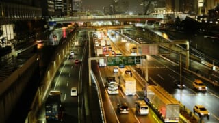
Once you are on the expressway, the signs are typically positioned every few kilometers, usually suspended high above the lanes on large metal gantries so they are visible from a long distance. You will almost always find them right before major Junctions (JCT) where the highway splits, allowing you to choose the route with less congestion. They are also prominently placed a few kilometers before the entrances to long tunnels, warning drivers of any accidents or stopped traffic inside the enclosed space.
Finally, you will often find smaller, supplementary electronic signs located just before the off-ramps for Service Areas (SA) and Parking Areas (PA). These specific signs usually display whether the parking lot at the upcoming rest stop is “Full” (満車), “Congested” (混雑), or “Empty/Available” (空有). Checking these smaller signs will help you decide whether to pull over for a break or continue driving to the next facility.
Deciphering the Color Coding System
The most effective way for a non-Japanese speaker to interpret the highway signs is to focus entirely on the color of the text. The color instantly communicates the urgency and nature of the message ahead.
Red Messages: Road Closures and Serious Accidents
If you see an electronic board flashing with bright RED text, it indicates a severe disruption that requires your immediate attention and action. Red is strictly reserved for the most critical situations: complete road closures, serious accidents blocking multiple lanes, or extremely hazardous weather conditions (such as a blizzard or a typhoon causing a landslide).
When a section of the highway is entirely closed, you will see the red text alongside the names of the specific Interchanges between which the closure has occurred. If you are already on the highway and approaching a red sign, it means the road ahead is either completely blocked or you will be forced to exit at the next available off-ramp. In this scenario, you must immediately reduce your speed and prepare for sudden stopped traffic. Do not attempt to bypass the forced exit, as the road beyond it is impassable and highly dangerous.
If you see a red message at the entrance to the toll gate before you get on the highway, it is a strong signal that you should alter your travel plans. Entering an expressway with a red warning often guarantees that you will be sitting in gridlock or redirected onto slower local roads very shortly. It is usually much better to stop, check your English navigation app for an alternative route, and wait for the situation to clear before proceeding. Red means stop, reassess, and prioritize your safety above all else.
Orange Messages: Traffic Jams and Weather Warnings
Orange (or amber) text is the most common warning color you will see on Japanese expressways, particularly if you are driving near major cities like Tokyo or Osaka during the morning commute, or during holiday periods like Golden Week. Orange indicates a significant disruption that will slow down your journey, but the road is still open and passable.
The most frequent use of orange text is to denote a traffic jam. The sign will typically display the location where the traffic jam starts and the total length of the congestion in kilometers (e.g., “5km”). This information is crucial for managing your time. If you see an orange sign indicating a 20km traffic jam ahead, it is highly recommended to pull into the next available Service Area (SA) to use the restroom and buy drinks, as you might be stuck in your car moving at a crawl for an hour or more.
Orange text is also used to issue weather warnings that require you to alter your driving behavior. You might see an orange message warning of heavy rain, dense fog, strong crosswinds, or icy roads ahead. When you see an orange weather warning, it is a direct instruction to reduce your speed below the posted limit, turn on your headlights to increase visibility, and increase the following distance between your rental car and the vehicle in front of you. Orange means caution: expect delays and drive defensively.
Green and White Messages: General Information
When the electronic boards are not flashing urgent warnings in red or orange, they will display standard, helpful travel information using green and white text.
What Green Text Means for Your Drive
Green text on a Japanese highway sign is the universal indicator of safety, smooth traffic flow, and general information. When the expressways are operating normally without any accidents, closures, or significant weather events, the electronic boards will often display messages in green.
Often, green text is used for public service announcements or safety reminders from the highway operator. You might see messages reminding drivers to buckle their seatbelts, take frequent breaks to avoid fatigue, or watch out for wildlife crossing the road in rural areas. While you may not be able to read the specific Japanese characters, seeing a board entirely in green should give you peace of mind that the route ahead is clear and safe.
In some urban areas, such as on the Shuto Expressway in Tokyo, green text is also used to indicate the names of upcoming exits or connecting routes. The consistent use of green reinforces a sense of normalcy and calm on the road, contrasting sharply with the urgent red and orange warnings. If your entire drive consists of passing under green signs, you are having a very lucky and efficient road trip.
Interpreting Travel Time Estimates in White
White text is almost exclusively used on the electronic boards to display estimated travel times to major upcoming destinations or Interchanges. These signs are incredibly useful for planning your drive and managing your schedule, and they are very easy to interpret even if you cannot read Kanji.
A typical travel time sign will display the name of a major city or a specific junction on the left side, followed by a number in white text on the right side, and the character for “minutes” (分). For example, if you are driving on the Tomei Expressway towards Tokyo, you might see a sign displaying “Tokyo (東京) 40分”. This simply means that under current traffic conditions, it will take approximately 40 minutes to reach the Tokyo exit.
These white travel time estimates are updated in real-time based on the data collected from sensors embedded in the road and ETC gates. If a traffic jam (indicated by an orange sign) suddenly develops ahead, you will notice the white travel time numbers increase significantly on the next board you pass. Monitoring these white numbers is a great way to verify the accuracy of your car’s GPS navigation system and decide whether you need to take a break at a Service Area before tackling the next leg of your journey.
Common Japanese Characters to Memorize
While relying on the color-coding system is usually sufficient, memorizing just a few crucial Japanese characters (Kanji) will drastically improve your ability to understand exactly what is happening on the road ahead.
Recognizing the Symbols for Traffic Jam (Jutai)
The most important and frequently encountered word on Japanese highway signs is “Jutai,” which means traffic jam or congestion. It is written with the two characters: 渋滞. When you see these two characters, they will almost always be illuminated in orange.
The sign will typically format the information by showing the location of the traffic jam followed by the length. For example, it might say “Next IC – 渋滞 5km”. This means there is a 5-kilometer traffic jam starting near the next interchange. If you are driving during a major holiday, you might see terrifying numbers like “渋滞 30km”, which indicates a massive gridlock.
If you see the characters 事故渋滞 (Jiko Jutai), this means the traffic jam is specifically caused by an accident. This type of congestion often clears much slower than normal volume-based traffic, as lanes may be blocked for emergency vehicles. Recognizing the characters for “Jutai” allows you to mentally prepare for the slowdown and make an informed decision about whether to pull over for a coffee break or take a detour.
Recognizing the Symbols for Accidents (Jiko)
The word for accident in Japanese is “Jiko,” written as 事故. This is another critical word to recognize, and it is usually displayed in red or orange depending on the severity and whether it is causing a secondary traffic jam.
When you see the characters for “Jiko,” it means there is a crashed or stalled vehicle ahead. The sign will often indicate which lane is blocked. If you see the characters combined with the word for closure (通行止 – Tsuko-dome), this is the worst-case scenario. It means the road is entirely closed due to a severe accident, and you will be forced to exit the highway. This combination is always displayed in flashing red text.
Another useful, related word to recognize is 工事 (Koji), which means construction or roadwork. Japan’s expressways undergo constant maintenance, mostly at night, so you will frequently see orange signs warning of “Koji” ahead. This usually means that one lane is closed for repairs, and you should be prepared to merge and slow down as you approach the flashing lights of the construction vehicles.
Supplementing Signs with English Navigation Apps
While the electronic boards provide the most immediate and authoritative updates, relying solely on them can be difficult for international drivers. The best strategy is to use modern technology to supplement the visual information on the road.
Using Google Maps and Navitime Alongside Visual Signs
The GPS navigation system built into your Japanese rental car is highly reliable, but the interface is often clunky, and the real-time traffic updates may not be easily understandable in English. Therefore, it is highly recommended to use a smartphone navigation app like Google Maps or the Japan-specific Navitime app alongside the car’s system.
When you see an orange “Jutai” (traffic jam) sign on the highway, immediately ask your passenger to check Google Maps. The app will visually display the traffic jam as a red or dark red line on your route, confirming the location and length of the congestion indicated by the electronic board. The app can also calculate whether taking a detour on local roads is faster than sitting in the highway traffic.
However, you must remember that the electronic highway boards (operated by NEXCO) always have the most current, localized data. If Google Maps says a road is clear, but the highway board flashes a red “Closure” sign, you must obey the highway board. The digital signs are directly linked to the highway patrol and emergency services, meaning their data is often minutes ahead of what a third-party app can process. Use your smartphone apps to confirm and plan around the information you read on the electronic signs, not to override it.
Listening to Highway Radio (1620 kHz)
If you look closely at the green metal signs along the side of the expressway, you will occasionally see a sign depicting an old-fashioned radio antenna with the numbers “1620 kHz”. This indicates that you are entering a zone covered by the Highway Advisory Radio system.
If you tune your rental car’s AM radio to 1620 kHz in these zones, you will hear a looped broadcast providing highly detailed, real-time traffic and weather information for the specific section of the highway you are driving on. Historically, this broadcast was only in Japanese, making it useless for foreign tourists. However, in recent years, especially on major routes like the Tomei and Shin-Tomei Expressways, NEXCO has introduced automated English broadcasts that play immediately after the Japanese announcement.
If you see a red or orange electronic board but cannot decipher the specific Kanji characters, tuning into 1620 kHz is a fantastic way to get an English translation of the situation. The broadcast will clearly state the location of accidents, the length of traffic jams, and any weather warnings. It is a brilliant, underutilized tool that can significantly reduce the stress of driving in a foreign country. For a more detailed guide on how to use this system, check out our article on Decoding Japanese Highway Radio: Essential 1620 kHz Information.
What to Do When You See a Warning Sign
Understanding the signs is only half the battle; knowing how to react safely and legally when you encounter a red or orange warning is equally important.
Adjusting Your Speed and Driving Behavior
The moment you see an orange warning sign for a traffic jam (渋滞) or an accident (事故), your first action must be to safely reduce your speed. Do not wait until you see the brake lights of the cars ahead of you. Slowly ease off the accelerator and increase the following distance between your rental car and the vehicle in front.
If you suddenly encounter stopped traffic, it is standard Japanese driving etiquette to immediately press your hazard lights button and let them flash for a few seconds. This is a crucial safety measure; it visually alerts the drivers far behind you that traffic has come to a sudden halt, giving them ample time to brake and preventing rear-end collisions, which are the most common type of accident in these situations. Once the car behind you has slowed down and turned on their own hazard lights, you can turn yours off.
If the orange sign indicates severe weather (like heavy rain or strong winds), you must adjust your driving to match the conditions. The speed limit on Japanese expressways is usually 100 km/h, but this is a maximum limit for ideal conditions. In heavy rain, the digital speed limit signs will often lower the legal limit to 80 km/h or 50 km/h. You must obey these lower digital limits, as the police strictly enforce them during bad weather.
Taking an Alternate Route via a Smart IC
If an electronic board displays a massive traffic jam or a red road closure ahead, you may need to exit the expressway to avoid being stranded. While you can always use a standard Interchange (IC) to exit, you also have the option of using a “Smart IC” if your rental car is equipped with an ETC card.
A Smart IC is an unmanned, ETC-only interchange that is often built directly into a Service Area (SA) or Parking Area (PA). They are designed to provide local residents with easier access to the highway, but they are incredibly useful for tourists looking to escape sudden gridlock. If you see a massive traffic jam ahead on the navigation app, you can pull into a Service Area equipped with a Smart IC, take a break, use the restroom, and then exit the highway directly from the parking lot onto the local roads.
- Check your navigation app to confirm a Smart IC is available at the upcoming Service Area.
- Ensure your ETC card is securely inserted in the reader (cash is not accepted).
- Pull into the Service Area and follow the signs marked “Smart IC (スマートIC)”.
- Approach the gate very slowly (stop completely before the bar).
- Exit onto the local roads and use Google Maps to navigate around the highway closure.
Using a Smart IC requires you to come to a complete stop right before the toll bar, unlike the standard 20 km/h roll-through at normal toll gates. It is a highly efficient way to bypass trouble, provided you understand the system.
Conclusion
Navigating the Japanese expressway system becomes significantly less intimidating once you understand how to decode the electronic information boards. These bright LED signs are not merely confusing displays of foreign text; they are a highly sophisticated, real-time safety system designed to protect drivers and keep traffic flowing smoothly. By learning to rely on the universal color-coding system, you can instantly gauge the condition of the road ahead and make safe, informed driving decisions without needing to read a single Japanese character.
Remember that RED means severe danger or a complete road closure, requiring immediate caution or a change in your route. ORANGE serves as a warning for traffic jams, accidents, or bad weather, indicating that you should slow down and drive defensively. GREEN and WHITE indicate normal conditions and provide helpful travel time estimates to keep your journey on track. Memorizing the two most common Kanji characters for traffic jam (渋滞) and accident (事故) will further empower you to understand exactly what challenges lie ahead.
By combining the visual cues from these electronic boards with modern technology like English navigation apps and the 1620 kHz highway radio broadcasts, you can master the Japanese expressways. Treat these signs as your most reliable co-pilot, guiding you safely through mountain tunnels, coastal bypasses, and urban junctions. With this knowledge in hand, your driving adventure in Japan will be safe, efficient, and wonderfully stress-free.